

I love scenic drives. Whenever I plan a trip, I always look to see if we can travel any scenic byways. I would say spending a relaxing day driving along the scenic Skyline Drive in Shenandoah National Park is an absolute must. Open all year round. A trip through this beautiful park must be on your bucket list! We drove the whole Skyline drive from the south to the north. Need help to plan your trip? These are a few of the must-see stops to experience on your journey.
This post may contain affiliate links, meaning if you purchase something through one of these links, we may earn a small commission at no extra cost to you! Read the full disclosure policy here.
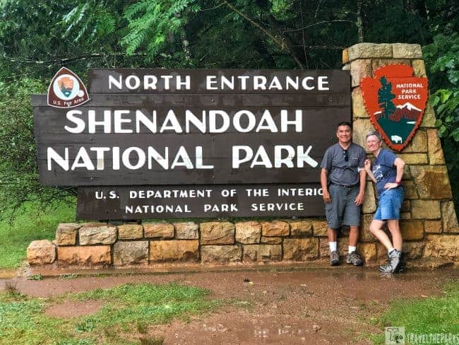
Shenandoah National Park spans 300 square miles of the Blue Ridge Mountains in the southern Appalachians. The state of Virginia established the park in 1935. The major feature of the park is Skyline Drive, which winds for 105-miles on the crest of the Blue Ridge Mountains from the north entrance at Front Royal to the terminus at the Blue Ridge Parkway south in Waynesboro. Skyline Drive extends to the Blue Ridge Parkway through Virginia. The Civilian Conservation Corps (CCC built most of Skyline Drive, and the landscaping, trails and structures). The construction of Skyline Drive through the Blue Ridge Mountains began in 1931.

Table of Contents
Getting to Shenandoah’s Beautiful Skyline Scenic Drive
- You can reach the park from Washington, DC, driving west on I-66 to Front Royal, Virginia. Exit to Route 340 South and follow signs for Shenandoah National Park and Skyline Drive.
- You can reach the park from Richmond, Virginia, driving west on I-64 to exit 99 and follow signs for Shenandoah National Park and Skyline Drive.
- You can reach the park from Pittsburgh, Pennsylvania, driving east on I-76 to exit 161. Take I-70 East to US-522 South. Follow VA-37 South to I-81 South. Follow I-81 South to I-66 East. Take I-66 East to Front Royal Virginia and follow signs to Shenandoah National Park and Skyline Drive.
- You can purchase America the Beautiful annual pass. It will get you entrance into all the National Parks and Federal Recreational Lands for one year.

Nearby Airports
- Washington Dulles International (IAD): 56 miles east of Front Royal
- Reagan National (DCA): 70 miles east of Front Royal
- Shenandoah Valley Regional (SHD): 27 miles west of Swift Run Gap
- Charlottesville-Albemarle (CHO): 31 miles east of Rockfish Gap
There are four entrance stations in Shenandoah National Park.
- Front Royal Entrance Station near Rt. 66 and 340
- Thornton Gap Entrance Station at Rt. 211
- Swift Run Gap Entrance Station at Rt. 33
- Rockfish Gap Entrance Station at Rt. 64 and Rt. 250 (also the northern entrance to the Blue Ridge Parkway).
Even if you drive straight through, at the max speed limit of 35mph, it will take 3-hours. Mileposts start in Front Royal (MM 0) and end in Rock Fish (MM 105), making it easy to find your destination. Be sure to request a park map at the entrance gate to Shenandoah or at one of the visitor centers.
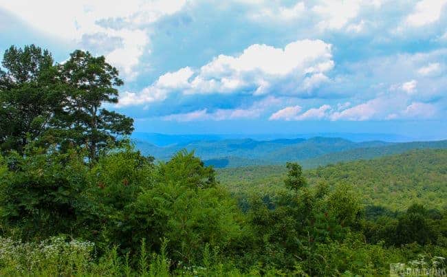
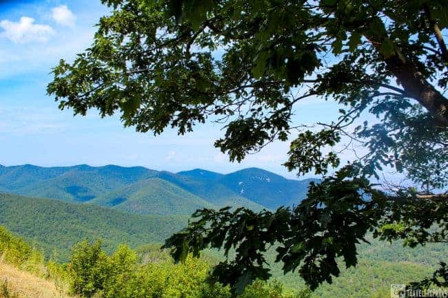
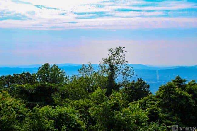
Top Viewpoints Along Skyline Drive in Shenandoah National Park – 75 Must-See Scenic Overlooks
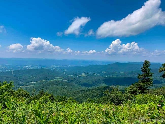
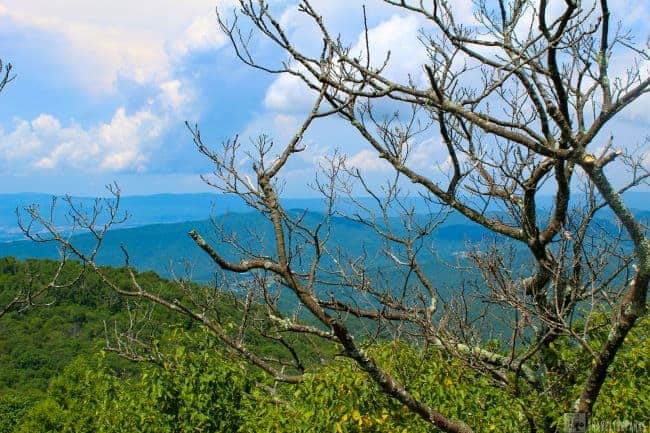
This peaceful drive has stunning scenic views with many overlooks on top of the Blue Ridge Mountains. You get amazing views of the Shenandoah Valley and Virginia Piedmont. There are overlook pullouts every few miles, so no worries take your time. We entered the park at the southern end of Skyline Drive, near Interstate 64 at Rockfish Gap Entrance Station. Driving the road in reverse, there was less traffic (most arrived via Front Royal). The park has 75 individually named observation points. I listed a few of our favorite overlooks.
NOTE: I did not understand why can’t drivers stick to the speed limits? We ended up using a lot of the overlook entrances just to let these people pass so they wouldn’t ruin our experience. It is not worth the aggravation.

McCormick Gap Scenic Overlook – Skyline Drive’s First Stop for Stunning Shenandoah Views (MM 102.5)
Our first stop was at milepost 102.5. Here, the northwest views look towards the city of Waynesboro. Surprisingly, the meadow of wildflowers captured our interest, watching the butterflies and bees on the many asters, purple thistle and milkweed flowers. A magnificent summer wildflower display!

Turk Mountain Overlook – Sweeping Valley Views on Skyline Drive in Shenandoah National Park (MM 93.5)
At milepost 93.5 it has the best views looking west towards George Washington and Jefferson National Forest about 34-miles away. Easy pull-off with plenty of space to park and stretch. Because of the time of day, it was slightly hazy, so not optimal for photography.
Loft Mountain Information Center & Campground: Camping and Resources on Skyline Drive in Shenandoah (MM 80)
Milepost 80, this is a good place for a restroom break. This is where we spotted deer browsing in the underbrush on the side of the road. I kind of jammed on the brakes so we could take her picture. This is the largest campground in Shenandoah National Park and sits atop Big Flat Mountain. You can easily access the Appalachian Trail via Loft Mountain Loop. You can also access the Doyle River Falls and Jones Run Falls from here or via Browns Gap Overlook parking lot.

Doyles River Falls Trail is a moderate 3.4-mile out and back trail. A little rocky, so you’ll definitely want your good hiking shoes, and bring water. The trail is downhill all the way, remember the hike back up is very steep. It is a nicely wooded walk through the deciduous forest to beautiful two pretty waterfalls. Not as impressive as others in the park, I think it is still worth the trip to see them.
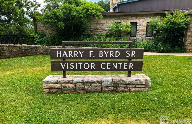
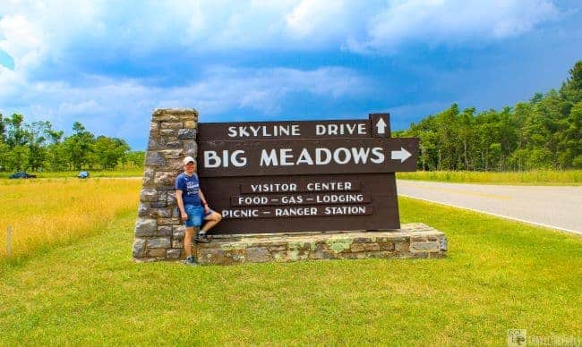
Big Meadows Visitor Center, Lodging & Campground: – The Heart of Skyline Drive in Shenandoah National Park (MM 51.2)
Take the time to stop at Big Meadows Wayside-milepost 51.2. The Harry Byrd visitor center is a good place for a stretch break. We took our picnic lunch under the shade of an immense pine tree, watching the afternoon storm approach. The camp store has food, drinks, and a wonderful selection of park souvenirs.
Big Meadows has an abundance of hiking trails that either start or pass-through and the level varies from easy to strenuous. The big meadow is an enormous expanse of grasslands that are a great place to view wildlife.
The Big Meadows facilities also include the Big Meadows Lodge and Campgrounds. The cornerstone of the lodge is the stone fireplace in the great room. We took a stroll up to Blackrock sitting on the Catoctin greenstone, watching an amazing lightning show over the valley in the distance. Black bears sightings frequently happen in this area, sadly we did not see any during our time in the park.
Spitler Knoll Overlook – Peaceful Valley Views (MM 48.1)
This is an ideal spot to watch the sunset located just at milepost 48.1 north of Big Meadows. The low sloping meadow makes photographing easy. Splendid views of the Shenandoah River and Page Valley lie below.
Skyland Resort– Iconic Lodging and Dining High on Skyline Drive (MM 41.7)
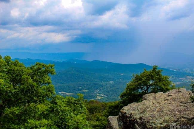
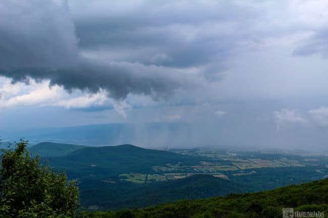
Driving past Skyland Resort milepost 41.7, we were lucky enough to witness an intense thunderstorm emerging. We have never seen the storm forming from above like this. Wow! the weather can change really quickly; we went from bright sunshine to thick mystical fog in about 50 yards. We took a break, waiting for the storm to subside before venturing out.

The sprawling property has several quaint cabins at the lodge, a restaurant, a small gift shop, and a riding stable. None of the rooms had A/C, so we opted for an Airbnb in the valley. Accessible trails from Skyland include the Stony Man and Whiteoak Canyon trails.
Jewell Hallow Overlook: Rolling Hills on Skyline Drive
This west-facing overlook has an elevation of 3330 feet with stunning views of the Shenandoah Valley to the distant town of Luray and Massanutten Mountains ridgeline. Milepost 36 has two parking lots. The trail for moderately strenuous Mary’s Rock and the Appalachian Trail is easy to access at the south end of the parking lot.

Mary’s Rock Tunnel– Iconic Drive-Through Landmark in Shenandoah (MM32.5)
At Milepost 32.5, Skyline Drive in Shenandoah National Park passes through the only tunnel in the park. The Mary’s Rock tunnel was built in 1932, blasted out of the solid granite it is 610 feet long. There is an overlook with some interpretive information on the south side with gorgeous views to the east. This was an unexpected delight to see this tunnel.
Dickey Ridge Visitor Center: Your Gateway to Shenandoah National Park on Skyline Drive (MM 5)
This is the first visitor center you will come across if you enter the Shenandoah National Park and Skyline drive from the North entrance at Front Royal. It has a classic National Park feel; the building reminds you of what you’d expect to see in a national park. There are expansive panoramic views of the Shenandoah Valley at milepost 5 and Signal Knob to the west. Ecological, geological, and cultural interpretive exhibits are excellent. We enjoyed the 15-minute orientation video about park history. Take a ranger-led walk happening daily on the 1.2-mile Fox Hollow Trail.
Best Shenandoah Hiking Trails-Skyline Scenic Drive
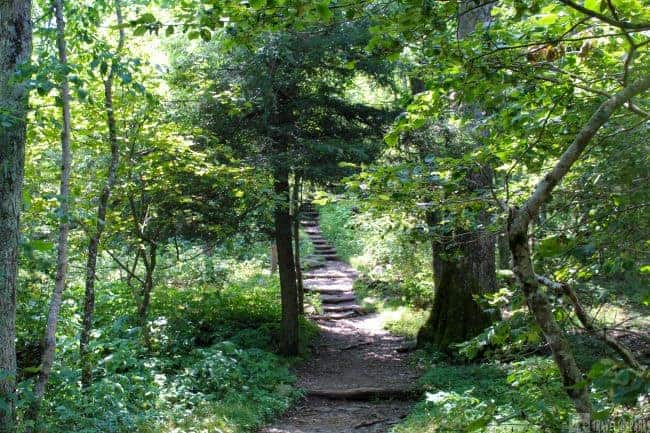
The park has tremendous views at every twist and turn off the road. Hikes are available for all fitness and ability levels. Understanding what the different trail blazes is will help you navigate better. Throughout the park, the paint trail blazes stripes on trees and rocks. Blue blazes signify hiking trails. White blazes signify the Appalachian Trail. Yellow blazes signify horse trails. Dogs are allowed on most trails but must be kept on leash.
Rapidan Camp Trail
Rapidan Camp, a group of three historic buildings built by President Herbert Hoover. The park offers a 2.5-hour ranger-led guided hike. Reservations are required and can be made online at Recreation.gov or by calling (877) 444-6777. Camp Rapidan is a National Historic Landmark. The trail follows an old fire road, making it a relatively easy 4-mile out & back hike. There are a few water crossings, so best to have waterproof hiking boots. If possible, plan to schedule your hike to coincide with the times a ranger gives tours of the buildings. The last remaining structures are the rustic Brown House, Prime Minister Cabin, and the Creel cabin (used by NPS staff).
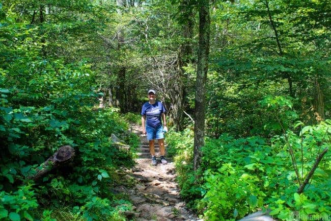
Hawksbill Gap Loop
This trail starts in the parking lot at milepost 45.6. The 1.7-mile trail to 4,051-foot-tall Hawksbill Mountain can be done as a loop. We did the Hawksbill Gap Loop counterclockwise, as the Shenandoah app suggests-taking AT and the Salamander Trail. At the end is a nice viewing platform with a superb view down into Linville Gorge. The photogenic “Byrds Nest” is an old rustic shelter for day use only. The descent is fast and quick!
Bearfence Mountain Trail

The trailhead parking is at milepost 56.4. Hiking Bearfence Mountain Viewpoint rewards you with stunning 360-degree panoramic views. This is an easy to moderate 1-mile loop. This is not the hike for the weak or weary knee’d. The trail junctions are very clearly marked. We followed the blue-blazed trail, reaching the challenging rock scramble on the forested ridge top. Again, proper hiking shoes are a must. It was a little daunting with drop-offs here and there, but the view at the summit is gorgeous! We returned via the white Appalachian Trail markers.
PRO Tip: A word of caution in the summer rattlesnakes frequent these rocks, so choose wisely when reaching for a handhold.
Overall Run Falls Trail
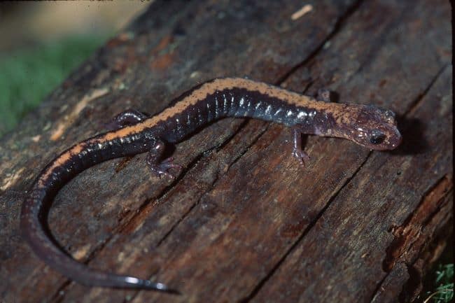
This is the park’s tallest waterfall. The 5.1-mile out & back trail is in the Mathews Arm Campground at milepost 22.2. They consider this hike moderate to the twin waterfalls. The toughest part of the hike is the steep descent into the gorge. First, you see the smaller 29-foot Twin waterfall following the trail further brings you to the Big Falls. The water flows are severely diminished this summer within the park, so the falls were not that impressive. I can imagine that in the spring, the falls would be spectacular. They allow dogs on this trail on a leash. We spotted a beautiful salamander in the pool at the first falls. It is a shame that they are falling victim to climate change.

Dark Hallow Falls Trail
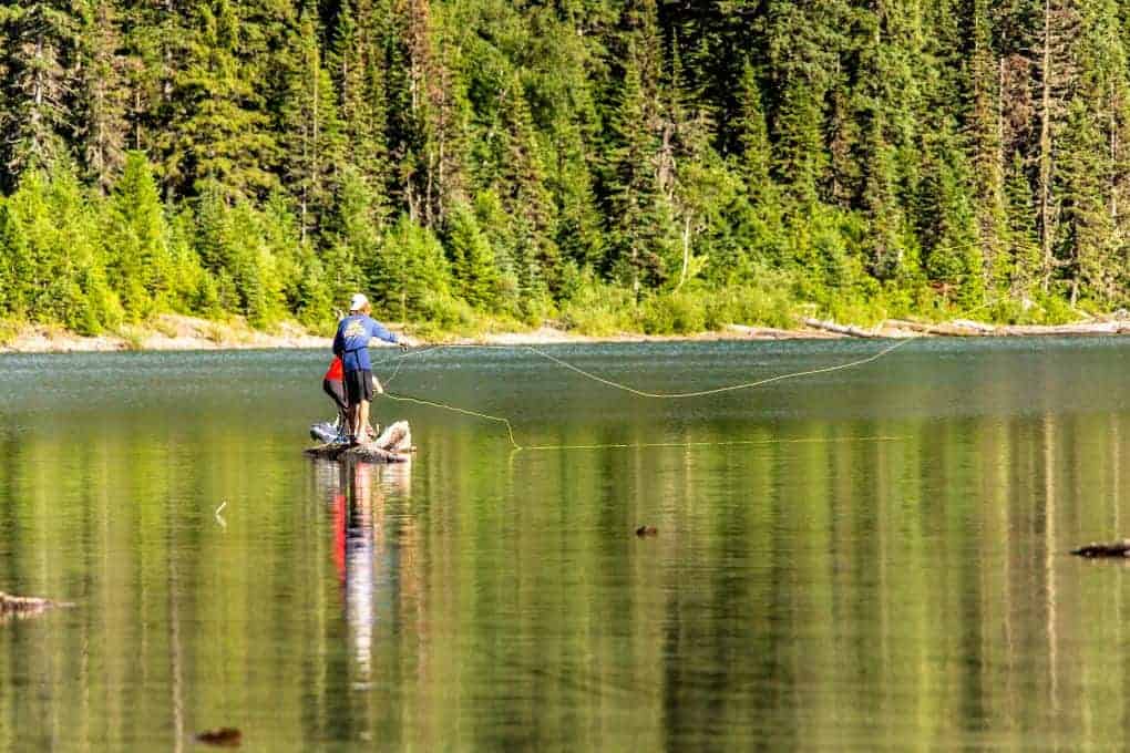
The trail is an easy 1.4 mile out and back, located just north of Big Meadows at milepost 50.7. This trail steeply descends 440 ft. from the parking lot through the forest before reaching the 70-foot cascading waterfall. The falls look heavenly, flowing over the moss-covered rocks surrounded by lush green vegetation. This is the closet waterfall to Skyline drive that being said it is extremely popular to arrive early! My thoughts looking at the clear stream turned to fly-fishing. However, the streams are low at this time of the year, too stressful for the trout. We did the hike in about 45 minutes. Although it was a little slippery, our good hiking boots managed the trail well. The hard part is the ascent back up the trail. This Florida girl was taking it in stride.

Old Rag Ridge Trail
This is one of the most popular hikes in the park, although the trail cannot be accessed via Skyline drive. The Old Rag Ridge Trail is on the east side, near Sperryville, accessed by the Berry Hollow fire road. The hike to the Old Rag summit takes a full day. Old Rag is a 5.4 miles strenuous hike. However, you’re rewarded with exquisite views (If you take the Weakley Hollow Fire Road you must navigate the rock scramble.). We recommend trekking poles for this hike and bring plenty of water, lunch, and snacks.
Starting on March 1, 2022, people who wish to hike in the Old Rag area, which includes the Saddle, Ridge and Ridge Access trails, will need to get an Old Rag day-use ticket in advance. You can purchase these tickets for Old Rag on Recreation.gov.
The trail begins on the Berry Hollow fire road, climbing fairly gently to intersect with the Saddle trail. Turn right to reach the summit you pass the day-use Byrds Nest Shelter. The climb is challenging. The trail near the summit ascends past cliffs, surrealistic boulders, and a couple of rocky outcroppings. The top can be crowded in the summer months. We did not experience a vast crowd, probably because we did this midweek. I can imagine the views would be beautiful in the fall with the changing leaves.
Lodging/Camping Skyline Drive
Three lodging accommodations are convenient along Skyline Drive at the following mile markers:
- Skyland – mile 41.7 and 42.5
- Big Meadows Lodge – mile 51
- Lewis Mountain Cabins – mile 57.5
If roughing it is your way to experience the national parks, then Shenandoah will not disappoint. Backcountry camping: you must have a permit to camp in the backcountry. Permits are free and can be filled out online. Additionally, there are four campgrounds for traditional camps. You may make campground reservations up to six months in advance. To make reservations go to Recreation.gov or call (877) 444-6777.
- Mathews Arm Campground-milepost 22.1 with 166 campsites.
- Big Meadows Campground-milepost 51.2 with 221 campsites.
- Lewis Mountain Campground-milepost 57.5 with 31 campsites on a first-come, first-served only.
- Loft Mountain Campground-milepost 79.5-largest campground area in the park with 205 campsites.

Tips for Driving Skyline Drive in Shenandoah National Park
- Bring snacks and plan to pack out your own trash. Leave no Trace.
- Cellular signal is non-existent here.
- Do you have a plan if you break down? Are your brakes working properly? Do you have the proper tools to change a flat tire should the situation arise?
- Start with a full tank of gas. There are very few stations along the way
- Bring binoculars and your camera.
- Avoid distracted driving, as there are many sharp curves and bends.
- Be prepared to share the road with bicyclists, pedestrians, motorcyclists, et cetera.
- Pack a picnic lunch as there are many sites to stop at with tables or you can choose to dine at the restaurant along the way
- For those of you (like us) who have a National Park Passport, there are stamp cancellation stations along the route.
Final Thoughts on Shenandoah’s Beautiful Skyline Scenic Drive
Unlike the Great Smoky Mountains, this park has a style all its own. Skyline Drive in Shenandoah National Park is truly one of the East Coast’s most breathtaking scenic routes, offering over 75 spectacular overlooks, abundant wildlife, and easy access to some of the best hiking trails in the Blue Ridge Mountains. Whether you’re embarking on a day trip or planning a multi-day adventure, these must-see stops—from Mary’s Rock Tunnel to Big Meadows and Skyland Resort—bring the beauty of Shenandoah to life at every turn.
Have you visited Shenandoah? If not, what do you think you would like best? Share your thoughts with us. We’d love to know your plans!

Kelly Marie
We’re planning a trip to Waynesboro and I am finding your post so helpful! Thanks for sharing.
Travel the Parks
Awesome! Enjoy your trip!