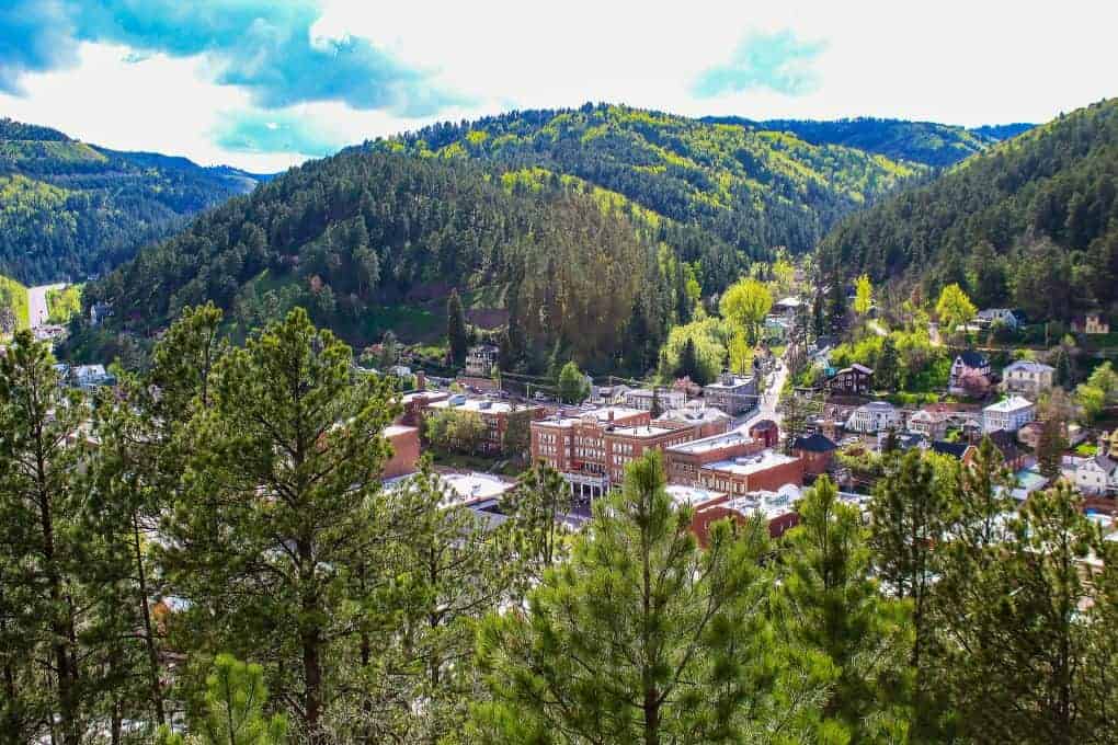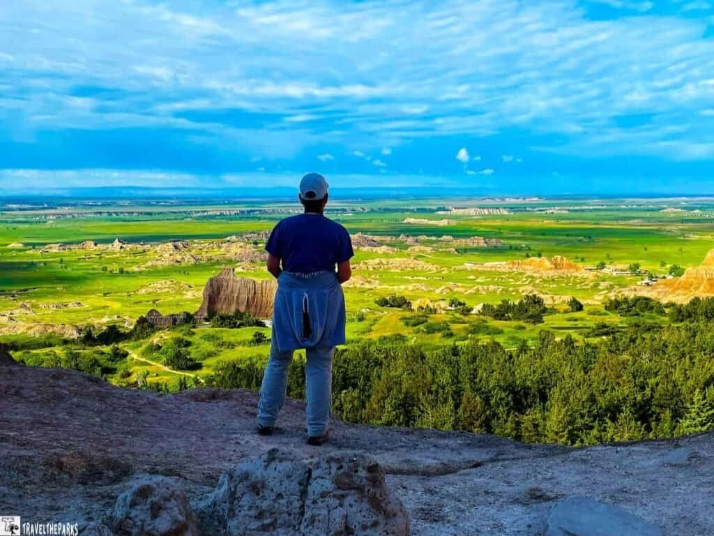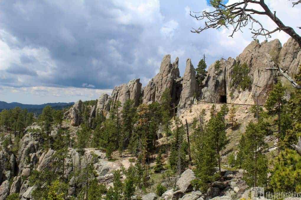
If you visit Custer State Park in the Black Hills of South Dakota and don’t drive the Needles Highway, you’re missing one of the state’s most spectacular scenic byways. To this day, it’s still one of the most beautiful roads we’ve ever traveled. Winding through towering ponderosa pines, granite spires, lush meadows, and narrow tunnels, the drive is unforgettable—but it’s even better when you get out and explore on foot. These hikes along the Needles Highway showcase some of the most dramatic scenery in the Black Hills and are a highlight of our South Dakota and North Dakota road trip itinerary.
Named for its towering needle-like granite formations, the Needles Highway offers breathtaking views around nearly every curve. Whether you’re looking for a short nature walk or a more challenging hike, these trails reveal landscapes you simply can’t appreciate from the road alone.

This post may contain affiliate links, meaning if you purchase something through one of these links, we may earn a small commission at no extra cost to you! Read the full disclosure policy here.
Table of Contents
Needles Highway: Your Gateway to Spectacular Hiking
We drove the Needles Highway (SD Highway 87) from US Highway 385 to US Highway 16A, beginning just a few miles from Crazy Horse Memorial. Before long, the 14-mile scenic byway twists through granite pinnacles and dense forests, climbing to an elevation of 6,339 feet. Although the drive itself is only 14 miles, plan on spending 2–3 hours to fully enjoy the overlooks, hiking trails, tunnels, and countless photo opportunities.
Wildlife sightings are common along the route. During our drive, we spotted marmots, mule deer, and rabbits, so be sure to keep an eye on the roadside as you travel.


How to Get to Needles Highway: A Quick Guide
The Needles Highway (SD 87) is located within Custer State Park and is easily reached from several popular Black Hills destinations.
- From Keystone: Take SD 244 west toward Mount Rushmore National Memorial, then continue to the junction with US 16/US 385. Turn left onto US 16A South, then immediately turn left onto SD 87 South toward Sylvan Lake.
- From Hill City: Follow US 16/US 385 South for approximately 4 miles, then turn onto SD 87 South toward Sylvan Lake.
- From Custer: Take US 16 east for about 8 miles to SD 87, then turn left to enter the Needles Highway.

Before your visit, check out our guide to Custer State Park for a map, must-see stops, and tips for making the most of your day.
The Needles Highway is typically closed during the winter months because of snow and icy conditions, so plan your visit between late spring and fall.
Note: A Custer State Park entrance pass is required to drive the Needles Highway. Check the current park fees before your visit, as admission prices are subject to change
Driving Through the Iconic Tunnels of Needles Highway
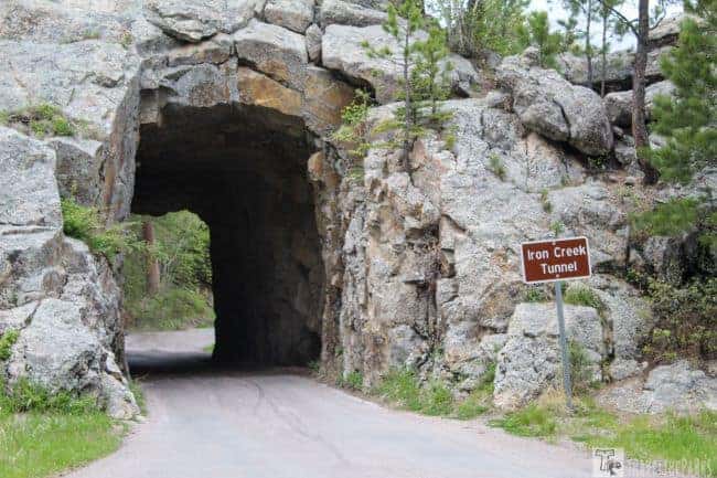
Carved through the granite pinnacles are three one-lane tunnels. In order from North to South is Hood tunnel the widest (10′ 6″ wide by 9’10″ high), then Needle eye tunnel (8′ 9″ wide by 9’8″ high), then Iron Creek tunnel (8′ 9″ wide by 10’10” high). Operating a moving vehicle through the tunnels can be daunting, not knowing what is on the other side. It was cool watching cars go through kids reaching out the windows to touch the granite walls. If you have a larger vehicle, be sure to check at the visitor centers before driving through the tunnels that you meet the size specifications to fit through.

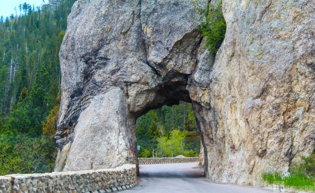
The Hood Tunnel: Your First Tunnel Experience on Needles Highway
Just to the west of Sylvan Lake is the first tunnel. Hood tunnel isn’t very long. There is a pullout on both sides to wait for oncoming traffic to clear. I can only imagine what it was like during the early days of construction blasting these granite outcroppings.
Threading Through the Needle Eye Tunnel: A Scenic Drive Highlight
The second and most magnificent is the Needle Eye Tunnel, 2-miles from south of Sylvan Lake. The longest tunnel, there are only a few parking spots directly in front of the tunnel. Luckily, we snagged a spot near the front. Named for the signature landmark Needles Eye found beside the tunnel.

This area contains some of the country’s oldest rocks, dating back 2 million years. The needle’s eye is a unique granite formation formed by wind and erosion. A rather impressive structure. Climbers come here from all over just to conquer these peaks. While waiting for the tunnel traffic to clear, we climbed around the spires, getting great views of the Black Hills. Passing through the tunnel, we continued on to the Cathedral Spires Trailhead.
Iron Creek Tunnel: A Hidden Gem on Needles Highway
The Iron Creek tunnel is the last tunnel we passed through. Named for the creek that follows closely to the Needles Highway. We pulled over just before the tunnel to watch a marmot on the side of the road. We had seen marmots in Yellowstone while in the Lamar Valley. I find them endearing. Passing through the tunnel, we continued toward Center Lake. The tunnels are a remarkable feat of engineering.

The Needles Highway hiking trail guide
While moving along the Needles Highway in South Dakota, you can find hikes of every level in Custer State Park. In the limited time we had on this trip, we were able to complete quite a few of the popular trails. Weather in the late afternoons turned stormy on a few days with rain, hail, and lightning. Keep your eyes to the sky and never underestimate how quickly the weather can turn.

Must-do hike on The Needles Highway Route: Sylvan Lake Shore Trail (#1)
The lodge at Sylvan Lake has restrooms, restaurant, store, and kayak rentals. We thought that the kayak-canoe rentals were a little pricy. Besides being a beautiful spot, the lake was also the setting for scenes from the movie “National Treasure 2: Book of Secrets.”
Early in the morning or just before sunset is prime time to walk the short 1-mile flat loop trail around Sylvan Lake. The lake is a popular spot for fishing and hiking. It is often crowded, but not today. Many trails begin at Sylvan Lake. The parking lot was full, but our trails did not seem crowded. We walked clockwise, making for the dam before turning left to complete the loop before making for Elk Peak. If you bear left before the dam, the trail cuts through a rock tunnel. At certain times of the year, the trail below the dam can be wet. A small bridge crosses the dam outflow. Climbing the rock outcroppings, you get panoramic views of Sylvan lake.
PRO Tip: Keep yourself hydrated and energized by bringing plenty of water and snacks.

Best hikes along The Needles Highway: Elk Peak- the Highest Peak (#9)
Originally called Harney Peak, they renamed it in 2016 after the renown medicine man and spiritual leader of the Oglala Sioux tribe, Black Elk. Interesting fact, it’s also the highest elevation between the Rocky Mountains in the western United States and the Pyrenees Mountains in France. The trail requires good hiking boots and trek poles.

If you have only a short time in the Black Hills, this hike is a must do! The moderately difficult 3.5 mile trail to the mountaintop begins at Sylvan Lake. The most accessible and easiest to follow is the #9 trail (Take #4 back to create a loop). This clearly marked trail moves through lush green meadows dotted with spring wildflowers before climbing through Ponderosa pine forests with amazing rock outcroppings gradually rising into the Black Elk Wilderness Area. There are plenty of places to stop and take a breather. We stopped to catch our breath at the kiosk, completing our permit before moving on. At two different places along the trail are benches, a quiet reprieve in the wilderness. Bring plenty of water. Do not underestimate how much you will drink.
PRO Tip: It is essential that you complete the wilderness self-registration permit at the wooden kiosk. Keep a copy with you; failure to have the permit could cause a hefty fine.

Experience Panoramic Vistas from the Fire Lookout Tower
The hardest push that made us quite winded was climbing the many metal stairs to the stone fire lookout tower. Sitting at the highest point at 7242 feet, the Civilian Conservation Corps constructed the abandoned tower in 1938. The tower’s enclosed observation deck gave us welcome relief from the hot sun. Inside, the 360-degree panoramic views of the Wyoming, Montana, Nebraska, and North Dakota were breathtaking. It is impossible to describe the rewarding sense of accomplishment we felt just getting to the top.

The rocks surrounding the peak are a great place to have a quick picnic lunch. On the backside out of the wind, we found an outcropping that gave us the feeling of solitude. Eating lunch, we reflected on the many prayer flags wrapped around the few trees that dot the mountaintop. The Lakota consider much of the area as sacred to the spirits. The prayer flags are homemade gifts left in tribute by those who make the pilgrimage to the mountain (out of respect, we took no photos). Clouds were moving in as we finished our meal.

Trails to Explore on your Needles Highway drive: Completing the Loop #4 Trail
We took a few photos of the fire lookout tower, investigated the pump house and small reservoir before descending back down the mountain. The Black Elk #4 trail traverses through thick Ponderosa Pine forest, creating a loop connecting back to Sylvan lake. Combining both trails is longer (total 7-miles), but you can do both Cathedral Spires (1.2 mile spur) and Little Devils Tower (0.2 mile spur). We chose to only do the Little Devil’s Tower as the clouds continued to build. We did not want to press our luck.

Don’t Skip Little Devils Tower Trail (#4): A Must-Hike in Custer
Taking the Black Elk #4 trail, it is a 0.2 mile spur trek to Little Devils Tower. If you start at the trailhead off, the Needles Highway, the hike is 3.6-miles out & back. Well-marked, just follow the blue dots (arrows). There is a bit of a rock scramble near the end of the trail. It’s 100% worth the effort for spectacular views of Custer State Park and the surrounding area.

Off-the-Beaten-Path: A Secret Trail Worth Exploring
As you return from Black Elk Peak, there is an opportunity to find the Poets’ Table trail via another spur trail. Within the pinnacles of the Black Hills lies a lonely set, a green table, and chairs and a bookcase. Apparently, they were placed there in 1969. Locals are aware of it, but don’t advertise its location. Despite being destroyed in 2018, a local carpenter replaced all the items. This unique trail has no markers and can be difficult to find. I think we were just lucky and stumbled upon the secret hidden trail. The views are spectacular of the Black hills, however, the graffiti on the walls was troubling to me.
PRO Tip: When hiking, to practice the 7 Principles of Leave no Trace.

Cathedral Spires: Towering Views and Unforgettable Trails
The trail to the Cathedral Spires is 2.3 miles out and back from the trailhead parking lot. There is a commemorative plaque showing it is a registered Natural Landmark. A little challenging as far as elevation, but the end justifies the means. Hiking boots and trek poles are a must on this rocky trail. Not to crowd at midday, we only encountered a few hikers. Steadily climbing in elevation, the trail rises to a plateau surrounded by tall granite spires. Stopping for a snack and a water break, we noticed mountain pine beetles had devastated a large area of the forest, which was a surprise to us. At the top of the trail, there is more slash timber than living Ponderosa Pines. A battle the park has been fighting since the 1990s.

Mountain Goats Ahead! Wildlife Encounters on the Trail
Near the end of the trail, we spotted a lone mountain goat browsing grasses in the pine slash. They are not goats in the true sense. The highlight for us on this trail. In fact, they are antelopes that are classified as goats. In contrast to true goats, mountain goats have slightly curved horns that are almost smooth. They introduced mountain goats into Custer State Park in 1924. We watched and photographed him from a safe distance before the distant rumble of thunder and darkening skies had us scrambling back to the safety of the car.

Why Sunday Gulch Trail Is a Must-Do on the Needles Drive
The trailhead starts at Sylvan Lake Lodge. This 3-mile loop trail was a favorite for us. Start the trail traveling counter-clockwise to get the tough part completed first. The rocky scramble over the boulders takes patience and a bit of determination. Therefore, the trail is moderately strenuous. Hand rails embedded in the rock boulders offer support. A good trekking stick provides additional stability.
Once you reach the gulch, the needle-like rock formations seem to jut out of the valley floor. There are a few creek crossovers and waterfalls that may get your feet wet/muddy. Spring wildflowers covered the meadow areas. In some areas near the creek, beware of the poison ivy. The shaded trail near the end hugs the needles highway for a mile of so, making it noisy. If I did the trail again, I would skip this part of the trail and do and out & back on the boulders section.

Relax and Explore: Grace Coolidge Creek Trail Along Needles Highway
Just past the Playhouse Road intersection with the Needles highway this is a great place to have lunch. Situated beside the creek, picnic tables and restrooms are available. Along the creek, there is a walkway leading to a small cave or grotto. There is a 3-mile trail that follows Grace Coolidge Creek from the campgrounds upstream meandering toward center lake. The trail crosses over the creek several times via small plank bridges. Not all were stable. The creek has many access points for fishing. Small dams create ponds for trout. Fly-fishing you can catch these stocked trout fairly easily. Wear long pants and watch for poison ivy and ticks (found one tick climbing the car window). Bug spray or clothing containing 0.5% permethrin can repel ticks.

Final Thoughts: Hikes to do when Driving The Needles Highway
WOW! The Needles Highway is one of the most spectacular scenic drives we’ve ever experienced. Winding through narrow tunnels, towering granite spires, and breathtaking overlooks, every mile offers another reason to stop and take in the view. While the drive alone is unforgettable, hiking along the way lets you experience the beauty of the Black Hills from an entirely different perspective.
These are just a few of the incredible hikes to enjoy along the Needles Highway, and we highly recommend adding this scenic drive to your South Dakota and North Dakota road trip itinerary. If you have extra time, don’t miss the equally scenic drives through Iron Mountain and Spearfish Canyon Scenic Byway, each offering its own unique landscapes and unforgettable views.
What is your experience with the Needles Highway in the Black Hills? How would you rate it? Do you have a favorite scenic road in the Black Hills?