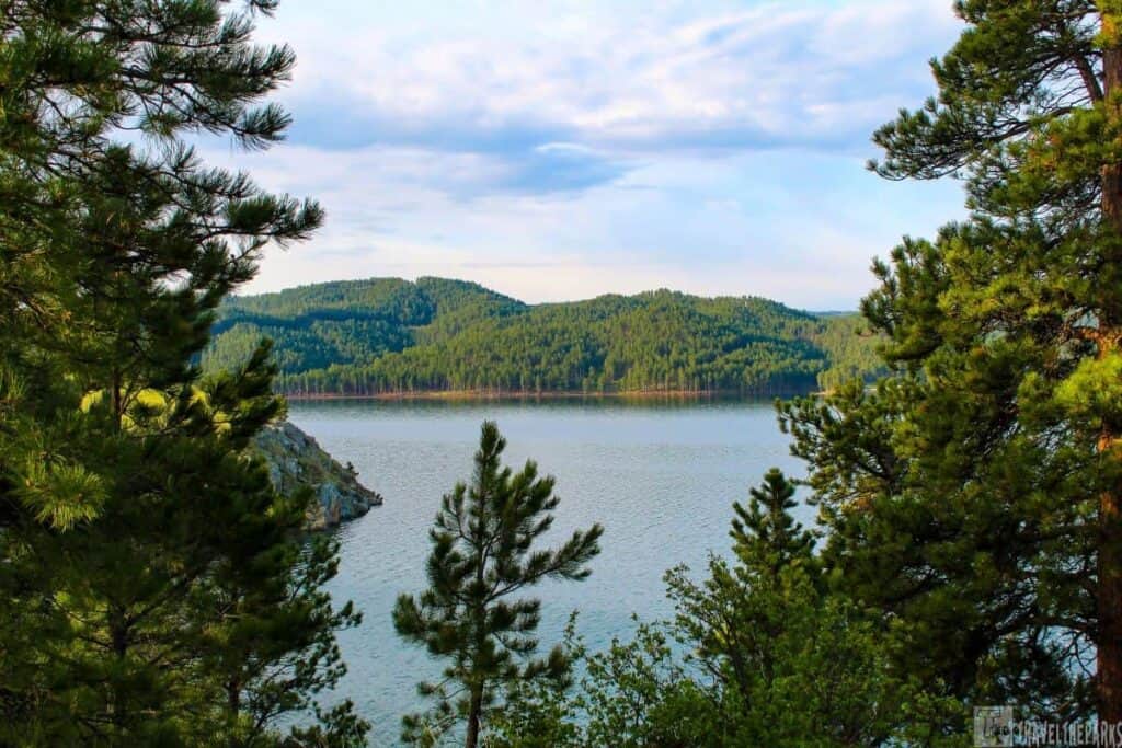
Looking for one of the most scenic hikes in the Black Hills? The trails and waterfalls along the Spearfish Canyon Scenic Byway offer an unforgettable adventure. Following Spearfish Creek through the heart of the Black Hills National Forest, this 19-mile scenic drive winds past towering limestone cliffs, lush forests, and some of South Dakota’s most beautiful waterfalls. Many of the canyon’s best waterfalls are just a short walk from the roadside, making this an excellent destination for hikers of all experience levels. It’s also one of the highlights of our South Dakota and North Dakota road trip itinerary, making it an easy stop on a longer Black Hills adventure.
We combined our visit to Spearfish Canyon with Devils Tower National Monument and the historic town of Deadwood, creating an unforgettable day trip through the northern Black Hills. It was a long day, but every stop was well worth the time.
This post may contain affiliate links, meaning if you purchase something through one of these links, we may earn a small commission at no extra cost to you! Read the full disclosure policy here.

Table of Contents
Where is Spearfish Canyon Scenic Byway?
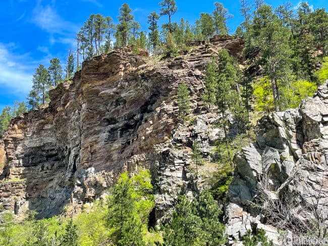
We entered the scenic byway from Exit 14 off Interstate 90 and followed the canyon south toward Deadwood, passing through Savoy, Cheyenne Crossing, and Lead. Along the way, towering limestone cliffs rise nearly 1,000 feet above Spearfish Creek, creating one of the most scenic drives in the Black Hills. We visited in summer, but the canyon is especially famous for its brilliant fall colors, when the aspens, birch, and oak transform the landscape into a sea of gold.

Make a Quick Stop at D.C. Booth Historic National Fish Hatchery (Mile 0)
Before heading deeper into Spearfish Canyon, we made a stop at the D.C. Booth Historic National Fish Hatchery & Archives, located at the northern entrance to the scenic byway. This free attraction is a worthwhile stop, especially if you’re traveling with kids or enjoy learning about local history.
Established in 1896 and listed on the National Register of Historic Places, the hatchery preserves more than 10 acres of historic buildings, fish ponds, and exhibits that tell the story of fish conservation in the Black Hills. The peaceful grounds are perfect for a short stroll before continuing into the canyon.
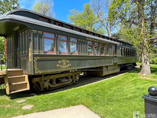
One of the highlights was seeing the historic Fisheries Railroad Car, once used to transport live fish throughout the Rocky Mountains, along with the hatchery boat that served Yellowstone National Park. Historic hatchery equipment, restored buildings, and informative displays provide a fascinating glimpse into the early days of fish culture in the United States.
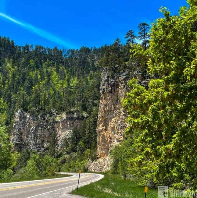
Split Rock & Community Caves Trail (Mile 2.7)
Split Rock is exactly what its name suggests—a massive limestone outcropping that was blasted to make way for the historic railroad line through Spearfish Canyon.
PRO Tip: Bring a daypack with plenty of water, snacks, sunscreen, and sturdy hiking shoes. The trail is steep, rocky, and can be slippery in places.
The pull-off for the Community Caves is on the right side of the road. Carefully cross the highway and ford Spearfish Creek to reach the unmarked trailhead. The 1-mile out-and-back hike is short but fairly strenuous as it climbs a steep, rocky hillside.
Simply follow the small stream as it winds uphill—you’ll know you’re on the right path. Along the way, you’ll reach a small waterfall that reminded us of the Emerald Pools Trail in Zion National Park. At the top, you’re rewarded with panoramic views of the Black Hills that make the climb well worth the effort.
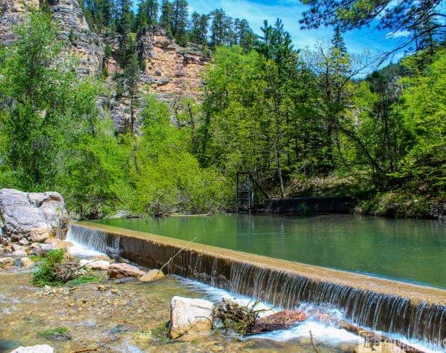
The Little Dam (Mile 4.3/MM15)
This small diversion spillway is excellent for both photographers and anglers alike. The remnants of the old diversion pond are downstream of the old plant. Evidently, it was destroyed during massive flooding in 1933. Good place to fish in the early morning, or to practice with a fly rod.
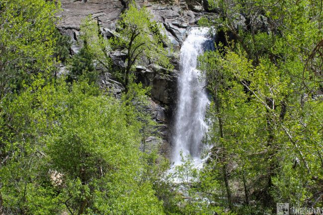
Bridal Veil Falls (Mile 5.8/MM16)
The 60 foot waterfall cascades over the towering canyon walls into Spearfish Creek. This is one of the simplest Spearfish Canyon waterfall hikes. The viewing platform is right beside the road, not easily missed. Because of the proximity to the road, this is the waterfall that everyone, and I mean everyone, stops to photograph. The parking area fills quickly. The amount of water flowing over the falls this spring was incredible; it was quite extraordinary. Spearfish creek was flowing higher than normal, so we opted not to cross to get an up-close view of the falls. We saw others using a log to cross to get to the base of the waterfall. In the summer, the cooler water of the creek would be mighty refreshing, but not today.

A Natural Rockslide Hike to Devil’s Bathtub (Mile 7.9/MM17)
Check out the Devil’s Bathtub a 2.0-mile out & back trail. Park at the turnout walk the 0.75 miles upstream before crossing a bridge. The trailhead is on the right. Be respectful as this follows private property. This is not an easy trail. There are no real trail markers, just follow the stream.
We had to cross the creek many times. But we did not let that discourage us from continuing. Be cautious, it becomes rocky and can be slippery, and poison ivy grows beside the trail. You can plan on feet getting wet. It Suggest wearing shoes you don’t mind getting wet. Trekking poles are a plus. The trail eventually leads to a natural rockslide that dumps into a “bathtub.” It was way too cold for that today. I can imagine that this would be marvelous in the hot summer months. Especially for kids.

Homestake Mine Hydro Plant 2 (Mile 8.1/MM18)
They constructed the first hydro plant in 1917 to sustain the Homestake Sawmill in Spearfish and the Homestake Gold Mine in Lead, South Dakota. Eventually, they diverted the water at this site. The water enters a flume traveling 12-miles. The delivered water turns two turbine generators near Spearfish. They still use many of the clay pipes today.
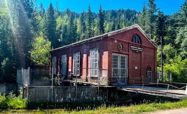
Interesting Fact: Homestake Gold mine was the number one producer of gold in the western hemisphere, making the state the top producer.
11th Hour Gulch and Kissing Rocks (Mile 9.3/MM20)
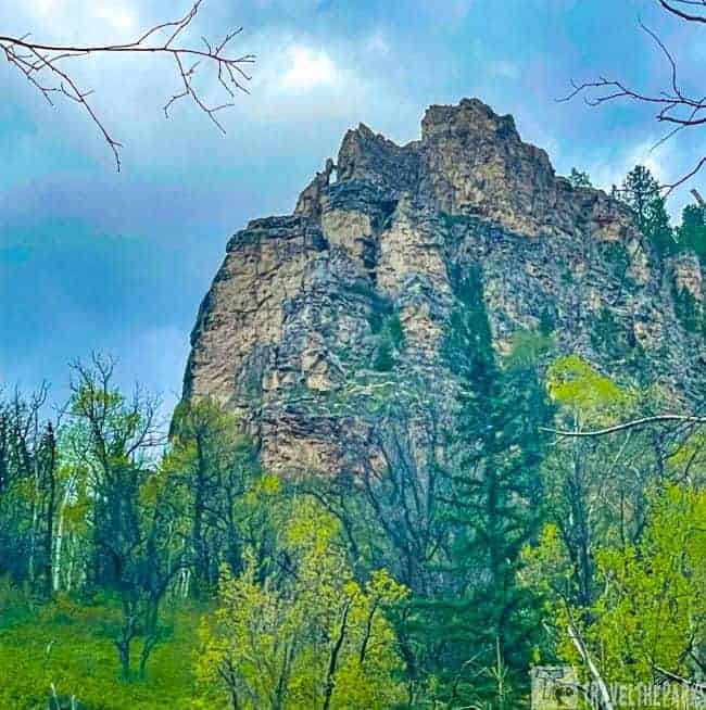
It is easy to miss this hidden hideaway. It is just around a bend at mile 9.3, next to the kissing rocks. Two large boulders that fell from the cliff face into the river bed below appear so close they are “kissing.”
11th hour gulch is a narrow 50 foot wide canyon is a challenging rock scramble. Because of its narrowness, the gulch receives only one hour of sunlight each day, hence its name. Someone has strategically placed old ladders to assist climbers on some of the larger boulders. Running out of time, we had to skip this hike. They say the views from the top are beautiful in the fall when the leaves change colors.
Long Valley Picnic Area Great Fishing in Spearfish Creek (Mile 10.8/MM22)
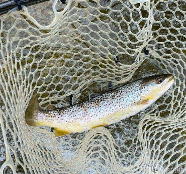
Spearfish Creek starts in the higher elevations of the canyon. Impressive that during its short course, Spearfish Creek drops 3,000 feet over its 40-mile length. At the half-way point, we ate picnic lunch before casting a fishing line in the creek. There is nothing better on a warm string day than sitting on a creek-side boulder enjoying a picnic lunch.
This is a premier fishery. The trout are not native to the Black Hills. The U.S. Bureau of Fisheries brought here them in 1899 hatchery from Colorado to Spearfish Creek. However, this creek supports a thriving population of wild trout. Good sized rainbow, brown, and brook trout can be caught in abundant numbers. The tackle we used was small trout spinners or a caddis in size #10-#20 and a tungsten jig nymph #12–#14. We called it a day in this section of the river because of the swift water. That’s why they call it fishing and not catching:)

Best waterfall trail in Spearfish Canyon is Spearfish Falls at the Savoy Crossroads (Mile 12.8/MM24)
This was our favorite waterfall during our trip to Black Hills of South Dakota. We easily accessed the trail for Spearfish Falls from the parking lot. It is located directly beside the Latchstring Restaurant, near Savoy. There is an upper walkway that leads to a viewing platform where you can overlook the top of the falls. The views are not that spectacular. Instead, take the 1.5 mile trail lower trail, the views are much better. Walk around the left of the restaurant to find the sign marking the trailhead for the Spearfish Falls Trail. After walking downhill and crossing a bridge, we arrived at the base of the falls. Although it is well-maintained, it has some steep grades (not accessible to wheelchairs). I suggest tennis shoes or hiking boots. The boardwalk platforms are both new and provide excellent views of the falls. We could see lots of brown trout in the clear waters.
Must-see waterfall in the Black Hills is at the Roughlock Falls Trail (Mile 13)
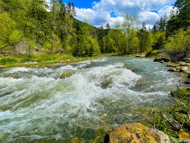
There are two ways to view Roughlock Falls. First is only a 1-mile walk down a forested trail across from the Latchstring Restaurant. It takes about 30 min one-way to walk the trail. The second viewpoint is about 1 mile west of Spearfish Falls on Forest Service Road 222. There is ample parking, a nice picnic area and restrooms. A 50-foot waterfall and cascades highlights this idyllic setting. There are two observation platforms connected by a raised boardwalk for photographing the falls.
They filmed the final winter scene for the movie Dances With Wolves a mere mile past the falls parking lot. A sign is posted marking the location. There is not much to see except the rock face, so if time is tight I would skip this.

The final stop at the end of the Spearfish Scenic Byway is Cheyenne Crossing. A good place to have a meal. It was originally a stagecoach stop on the Cheyenne to Deadwood route in 1878. At the intersection, we headed to our next destination through Lead to Deadwood for an early supper.
Note: The Black Hills are home to several incredible scenic byways. If you have time, add Iron Mountain and the Needles Highway to your itinerary for even more unforgettable views.
Final Thoughts: Hiking the Most Popular Waterfalls in Spearfish Canyon
The Spearfish Canyon Scenic Byway is one of the most beautiful drives in the Black Hills and an absolute must-see when visiting South Dakota. From towering limestone cliffs and peaceful hiking trails to cascading waterfalls and abundant wildlife, every stop offers something memorable. Whether you’re looking for a quick roadside waterfall or a longer hike through the canyon, Spearfish Canyon is a destination you’ll want to explore at your own pace.
For the ultimate Black Hills adventure, include Spearfish Canyon in your South Dakota and North Dakota road trip itinerary, where it’s one of 15 unforgettable stops across the Black Hills, Badlands, and Theodore Roosevelt National Park.
Have you hiked in Spearfish Canyon before? Let us know your favorite trail in the comments!